Apps for adventurers and mountain lovers
GOOGLE PLAY STORE - APPLE APP STORE
Peak - the ultimate Altimeter GPS and Barometer app designed for hiking, trekking, and exploring nature. Gain precise, real-time insights into your elevation, atmospheric pressure, and geographical coordinates using your device's built-in sensors.
Unlock features such as accurate altitude readings in both meters and feet, real-time monitoring of atmospheric pressure changes, pinpoint location tracking with detailed longitude and latitude coordinates, integrated step counting for fitness tracking, visual weather updates based on barometric pressure readings, and customizable measurement units for a personalized experience.
With a user-friendly interface and reliable accuracy, Peak is your essential companion for understanding your surroundings and predicting weather changes during outdoor adventures. Download Peak today and elevate your outdoor experiences to new heights!
Welcome to Alpy Technologies, the ultimate destination for mountain enthusiasts, climbers, trekking aficionados, and mountain bikers. We are a company dedicated to creating exceptional Android apps that elevate your outdoor experience.
Our apps are designed specifically for those who seek adventure, challenge, and a deep connection with nature. Among our flagship creations, you'll find the GPS Altitude Meter for Android, providing you with accuracy and reliable altitude detection during your escapades. Our Topos app offers detailed topographic maps to navigate safely through challenging terrains, while OSM opens the doors to open-source maps for Android based on OpenStreetMap, ensuring access to up-to-date and precise informations.
At Alpy Technologies, we pour our hearts into every creation, dedicating passion and commitment to every line of code. Our mission is to make your outdoor adventures more memorable and rewarding, providing innovative technological solutions that seamlessly blend with the mountain environment. Choose Alpy Technologies and take a step forward into unparalleled outdoor experiences.

"Elevate Your Adventures with Alpy Tech Apps: Where Technology Meets the Mountains!

Navigating the Outdoors, Empowered by Open Source: Unveil the World with Alpy Tech Maps!

Empowering Innovation: Unleash Possibilities with Alpy Tech Developer Hub
At Alpy Technologies, we pour our hearts into every creation,
dedicating passion and commitment to every line of code.
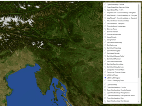
OSM - Open Street Maps & GPS is an incredibly versatile and valuable application that provides users with the opportunity to access and interact with a wide range of maps from the renowned source, OpenStreetMap. This app goes well beyond the mere display of standard maps, as it offers users a comprehensive and engaging mapping experience. A fundamental feature of OSM - Open Source Map is its quick switching capability between different maps. Users can seamlessly transition from one map to another, enabling seamless exploration and optimized access to geographical information. (DOWNLOAD FREE)
Satly - the essential app for testing and understanding the real-time performance of your GPS/GNSS system! A must-have tool for platform engineers, developers, and advanced users, Satly provides you with detailed information about satellites visible to your device. (DOWNLOAD FREE)
Sportly - the GPS sport tracker that respects your privacy. Elevate your passion for sports and adventure with Sportly, your loyal companion for outdoor activities that values your privacy. Whether you're an avid runner, an enthusiastic cyclist, or simply love walking in nature, Sportly is here to enrich your experience. (DOWNLOAD FREE)
Explore our planet in an entirely new way through the extraordinary precision of Topos - topographic maps, your ultimate guide to navigating rugged terrain. Dive into highly accurate topographic maps that unveil every single detail of the landscape, from the curves of elevations to varying altitudes. Whether you're a passionate hiker in search of new destinations, an outdoor adventure enthusiast, or an explorer seeking ever more exhilarating challenges, Topos - Topographic Map is your indispensable ally, providing essential tools to navigate with total safety and awareness. (DOWNLOAD FREE)
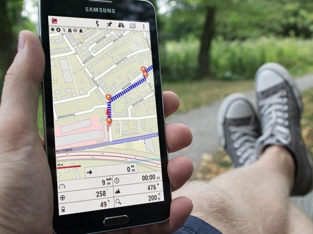
Explore the world worry-free with GPS Altimeter, the app that works completely offline and respects your privacy. With powerful sensors, enjoy precise and reliable navigation without the need for an internet connection. Record your location, track your routes, and backtrack safely. Stay prepared for sudden weather changes with offline weather forecasts. Protect your personal data as GPS Altimeter never shares your location information. (DOWNLOAD FREE)
Explore the world worry-free with GPS Altimeter, the app that works completely offline and respects your privacy. With powerful sensors, enjoy precise and reliable navigation without the need for an internet connection. Record your location, track your routes, and backtrack safely. Stay prepared for sudden weather changes with offline weather forecasts. Protect your personal data as GPS Altimeter never shares your location information. No ADS. Please, support us. (DOWNLOAD FREE)
OSM - Open Street Maps & GPS is an incredibly versatile and valuable application that provides users with the opportunity to access and interact with a wide range of maps from the renowned source, OpenStreetMap. This app goes well beyond the mere display of standard maps, as it offers users a comprehensive and engaging mapping experience. A fundamental feature of OSM - Open Source Map is its quick switching capability between different maps. Users can seamlessly transition from one map to another, enabling seamless exploration and optimized access to geographical information. (DOWNLOAD FREE)
OSM - Open Street Maps & GPS is an incredibly versatile and valuable application that provides users with the opportunity to access and interact with a wide range of maps from the renowned source, OpenStreetMap. This app goes well beyond the mere display of standard maps, as it offers users a comprehensive and engaging mapping experience. A fundamental feature of OSM - Open Source Map is its quick switching capability between different maps. Users can seamlessly transition from one map to another, enabling seamless exploration and optimized access to geographical information. (DOWNLOAD FREE)

Explore the world worry-free with GPS Altimeter, the app that works completely offline and respects your privacy. With powerful sensors, enjoy precise and reliable navigation without the need for an internet connection. Record your location, track your routes, and backtrack safely. Stay prepared for sudden weather changes with offline weather forecasts. Protect your personal data as GPS Altimeter never shares your location information.
At Alpy Technologies, our passion is reflected in every line of code we write. We're dedicated to fusing innovative technology with the grandeur of the mountain landscape, ensuring your outdoor experiences are unparalleled.
the ultimate Altimeter GPS and Barometer app tailored for hiking, trekking, and exploring the great outdoors. Stay informed about your elevation, atmospheric pressure, and geographical coordinates in real-time, leveraging your device's built-in sensors.
Unlock a suite of features including precise altitude readings in meters and feet, live monitoring of atmospheric pressure variations, accurate pinpointing of your location with detailed longitude and latitude coordinates, integrated step counting for fitness tracking, visual weather updates based on barometric pressure readings, and customizable measurement units to suit your preferences.
With an intuitive interface and dependable accuracy, Peak is your indispensable companion for navigating the wilderness and anticipating weather changes during your outdoor endeavors. Download Peak today and elevate your outdoor experiences to unparalleled heights!
Altimeter GPS for Android is the perfect app for outdoor enthusiasts like me. It's easy to use, with an intuitive interface and detailed information about altitude, weather, and sunrise/sunset times. It has helped me explore new and remote locations with confidence. Highly recommended for anyone who loves adventure!

Martin Smith
⭐️⭐️⭐️⭐️⭐️
This app is a fantastic resource for climbers. It gives me my current altitude in real-time, which is crucial for avoiding altitude sickness. Additionally, the sunrise and sunset calculations help me plan my climbs based on available natural light. I can't go without this app during my mountain challenges.

Jessica Brown
⭐️⭐️⭐️⭐️⭐️
This app is a must-have for every hiker! It helped me navigate in remote areas without an internet connection, showing me my exact altitude and sunrise/sunset times. It's reliable, accurate, and easy to use. Highly recommended for adventure enthusiasts!

Johanna Rosaly
⭐️⭐️⭐️⭐️⭐️
I'm a mountain enthusiast, and this app has been a great help during my hikes. It provides me with accurate information about my altitude, weather forecasts, and sunrise/sunset calculations. It's a reliable companion that helps me plan my adventures safely and precisely

Federico De Marchi
⭐️⭐️⭐️⭐️⭐️